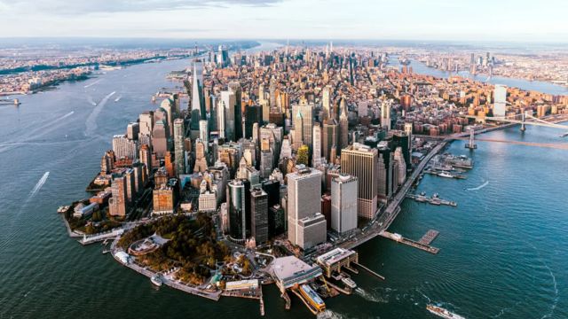
A study claims that these six NYC areas are sinking
New York City, a vibrant metropolis known for its towering skyscrapers and bustling streets, is facing a less visible but equally significant challenge: certain areas of the city are sinking faster than others.
This phenomenon, known scientifically as subsidence, refers to the gradual sinking or settling of land. A recent study conducted by the prestigious Rutgers University Department of Earth and Planetary Sciences, in collaboration with NASA’s Jet Propulsion Laboratory, shines a light on this pressing issue.
The comprehensive study, which monitored New York City’s land movement from May 2016 to March 2023, found that while the city as a whole is descending at a median rate of 1.6 millimeters per year, six specific locations are experiencing a more rapid decline. This finding is alarming, particularly for the residents and frequent visitors of these areas.
The Six Sinking Locations of New York City
- Arthur Ashe Stadium, Queens: This iconic tennis arena is experiencing the most significant subsidence, sinking at a rate of 4.6 millimeters annually. Known for hosting legendary U.S. Open matches, the stadium’s subsidence issue is exacerbated by its history as a landfill site. Measures have been taken to mitigate the impact, such as the installation of a specialized, lightweight retractable roof to avoid adding extra weight to the structure.
- LaGuardia Airport, Queens: Notorious for its congestion and delays, LaGuardia’s longest runway is sinking at a rate of 3.7 millimeters a year. This presents a challenge, especially as sea levels rise, prompting an $8 billion project to protect the runway from seawater flooding.
- Governor’s Island, Manhattan: A beloved location for music festivals and leisure, Governor’s Island is sinking by 3.4 millimeters annually. Much of the island was constructed using debris from subway excavations, contributing to its subsidence.
- Arverne by the Sea, Queens: This residential neighborhood, redeveloped post-Hurricane Sandy, is sinking at 3.2 millimeters a year. Built on artificial fill, the area remains vulnerable despite surviving past storms with minimal damage.
- Midland Beach, Staten Island: With a subsidence rate of 2.8 millimeters per year, this beachfront area is on alert. Geologists predict significant sinking over the coming century, though the exact impact remains uncertain.
- Coney Island, Brooklyn: Famous for its amusement parks and beaches, Coney Island is also sinking, at a rate of 2.6 millimeters annually. Like Arverne by the Sea, this area is built on artificial fill, contributing to its downward trend.
The study also highlighted two highways with portions in New York experiencing similar issues: Highway 440 and Interstate 78, both sinking at rates of 2.8 and 2.7 millimeters per year, respectively. These highways, critical for transportation, further exemplify the widespread nature of subsidence in the region.
Understanding and Addressing Subsidence
The gradual sinking of these areas may seem minimal at first glance, but the long-term implications can be substantial. Infrastructure can become compromised, flood risks can increase, and the safety and well-being of residents and visitors can be jeopardized.
The subsidence rates, particularly for sites built on landfill or artificial fill, underscore the importance of monitoring, maintenance, and proactive planning to mitigate future risks.
Subsidence in New York City is a complex issue, driven by a combination of natural and human-induced factors.
Understanding these dynamics is crucial for developing effective strategies to address the challenges posed by sinking land. The study conducted by Rutgers University and NASA is a step forward in this direction, providing valuable data that can inform city planning, infrastructure development, and community resilience efforts.
As New York City confronts the reality of subsidence, the findings serve as a reminder of the importance of sustainable urban development and the need for continued research and adaptation.
While the city may not be facing an immediate crisis, the gradual descent of these key locations highlights the need for vigilance and proactive measures to ensure the safety and stability of America’s most populous city.


