


Florida’s Heat Hits New Heights: Cities Set Back-to-Back Temperature Records
The Sunshine State continued to see high temperatures on Thursday; one meteorologist put the conditions in Southwest Florida at “about as hot as we can get.”
On Wednesday and Thursday of this week, the cities of Tampa, Sarasota-Bradenton, and Punta Gorda set daily temperature records, according to the National Weather Service (NWS) in Tampa Bay.
Tampa saw a high of 98 degrees on Thursday, while Sarasota-Bradenton recorded a high of 99. Punta Gorda residents endured triple-digit temperatures, with highs of 101 degrees. According to the NWS, the city in Southwest Florida’s previous record for daily heat was set on May 30, 2000, at 97 degrees.
Additionally, St. Pete had a daily high temperature of 96 degrees on Thursday. At 97, Fort Myers equaled its daily high.
“This is literally about as hot as we can get!” Chief meteorologist Paul Dellegatto of Tampa’s WTVT wrote on X (formerly Twitter).

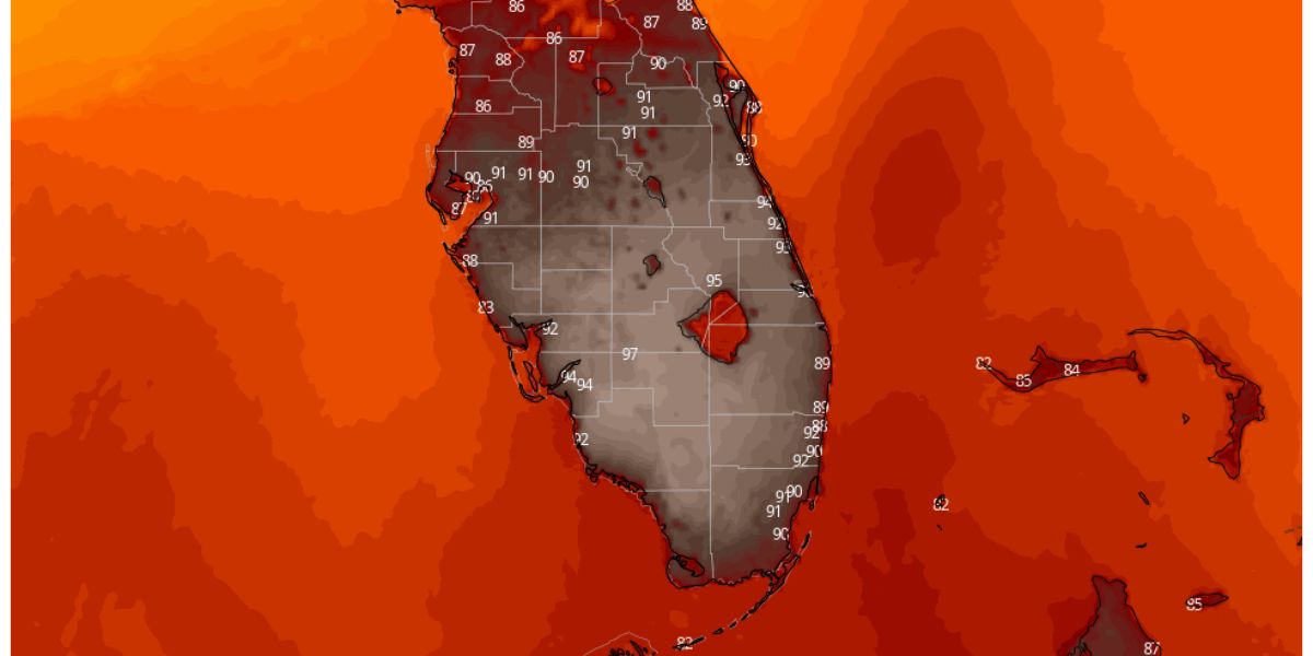
Additionally, Dellegatto provided a map illustrating the high temperatures recorded on Thursday across southern and central Florida.
SEE MORE – Urgent Weather Update: Tornado Warnings and Watches Across DC, Maryland & Virginia
Over the last week, Florida residents experienced the first taste of summer, with record temperatures set across the state. Both Brooksville and Winter Haven set new records for daily high temperatures on Wednesday, reaching 97 and 99 degrees, respectively.
Over Memorial Day weekend, there were also several day highs. On Sunday, the temperatures in Miami (96 degrees), Orlando (97 degrees), and West Palm Beach (95 degrees) all smashed records. This week, extreme heat was experienced by large portions of Texas as well; on Wednesday, the heat index in some cities was well over 100.
The Tampa Bay area saw temperatures between the mid-60s and the mid-70s on Thursday night, according to NWS. On Friday, there was also a chance of rain heading into southwest Florida, with Tampa and Sarasota seeing a 50% probability. Friday is expected to see highs in the nineties.
On Friday, there is also a chance of isolated showers in South Florida. For the bottom of the Florida peninsula through Wednesday, the NWS has issued a hazardous weather forecast, stating that stormy weather moving into the area could result in “lightning, gusty winds, and locally heavy rainfall.”
“The strongest activity could produce small hail and a few locally strong to severe wind gusts,” the National Weather Service stated.
According to the warning, there will be a greater chance of rip currents throughout the East Coast during the weekend, and dangerous “marine conditions” might occur along the Atlantic coast on Sunday.
The counties Miami-Dade, Palm Beach, Collier, Broward, and Broward are included in the hazardous outlook.
In Florida, the Farmer’s Almanac’s 12-month forecast called for an abnormally wet May, a dryer-than-normal June, and pretty ordinary July and August—though a little on the dry side both months, with July being a little hotter than usual.