


Saharan Dust Set to Blanket the Atlantic: Florida Could See Impact Soon
ORLANDO, Fla. – Following the passage of Tropical Storm Alberto, no new tropical development is expected over the next seven days. Instead, Saharan dust is poised to dominate the tropical Atlantic in the coming week.
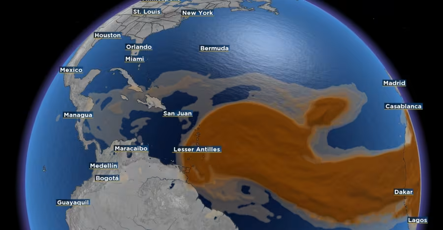
This time of year typically sees the peak of Saharan dust across the tropical Atlantic. The dust will gradually move through the Caribbean Islands as the weekend approaches.
Some of this dust could make its way to Florida over the weekend.
Within this dusty plume are a couple of tropical waves. One of these waves is likely to impact the Windward Islands. However, it is expected to remain weak as it traverses the eastern Caribbean.
According to the source, the region’s strong wind shear will hinder any significant development. There might be a small opportunity for development once this wave moves away from the dust in the western Caribbean.
Another tropical wave is currently emerging from the African coastline. Some weather models suggest there could be some development before this wave reaches the Lesser Antilles at the start of July.
However, any development is uncertain due to the presence of Saharan dust lingering just north of the tropical waves.
The next named storm of the 2024 hurricane season will be Beryl.
Read more news:
- Triumph in Tennessee: Local Woman’s Victory Over Addiction and Academic Success
- Church Vandalism in Irwin: Youths Suspected of Damaging Sacred Instruments at Local Church