


Weather Warning: Hail and Damaging Winds Target America’s Heartland
As one storm system exits the country, another is on its heels, with thunderstorms forecast to rage across a 1,000-mile length of the country on Thursday.
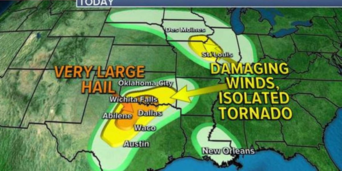
The Storm Prediction Center has identified states from the U.S.-Mexico border to the Ohio Valley as being at high risk of storms, with Missouri, Illinois, Indiana, Kentucky, and Tennessee being the most vulnerable. Unlike earlier occurrences, where various types of severe weather were expected, the FOX Forecast Center cautions that hail, damaging winds, and flooding will be the main concerns.
“The highly likely area extends from Saint Louis to northern Tennessee and portions of western Kentucky. So, Paducah, again, with the possibility of a very real hazard,” said FOX Weather meteorologist Steve Bender. Because of the misalignment of atmospheric elements, forecasters do not expect the tornado threat to be the most pressing issue, and after midday temperatures subside over the region, cells tend to lose a lot of their power overnight.
The frontal boundary’s delayed movement, combined with recent high rainfall in the Ohio Valley, will increase the risk of floods, particularly on its northern and southern levels.
According to forecast models, the Lone Star State might receive up to 2-3 inches of rain by the end of the week. Rainfall accumulations in the north are not projected to be large, but several rivers and streams in the Ohio Valley are nearly full.
Some cities along the Ohio River have flooded twice in two weeks, thanks in part to an unpredictable weather pattern that puts Pittsburgh on course for its wettest April on record.
Refreshing Airmass Behind the Chilly Front
The front will usher in unusually cold weather for mid-April, which may feel chilly for some. Temperatures will struggle to reach the 60s, compared to recent highs in the 70s and 80s across the Plains. Chicago will be one of many places affected by the chill, with high temperatures anticipated to be 5-10 degrees below average through the weekend.
The cooler and drier air is projected to reach the Interstate 10 corridor by next week, with New Orleans experiencing a few days with highs in the lower 70s.