


Central Illinois Braces for Weekend Storms: A Forecast Overview
A succession of powerful storm systems will deliver many rounds of rain and storms to Central Illinois over the weekend. It won’t be a complete washout, but severe weather and heavy rain are forecast.
Friday
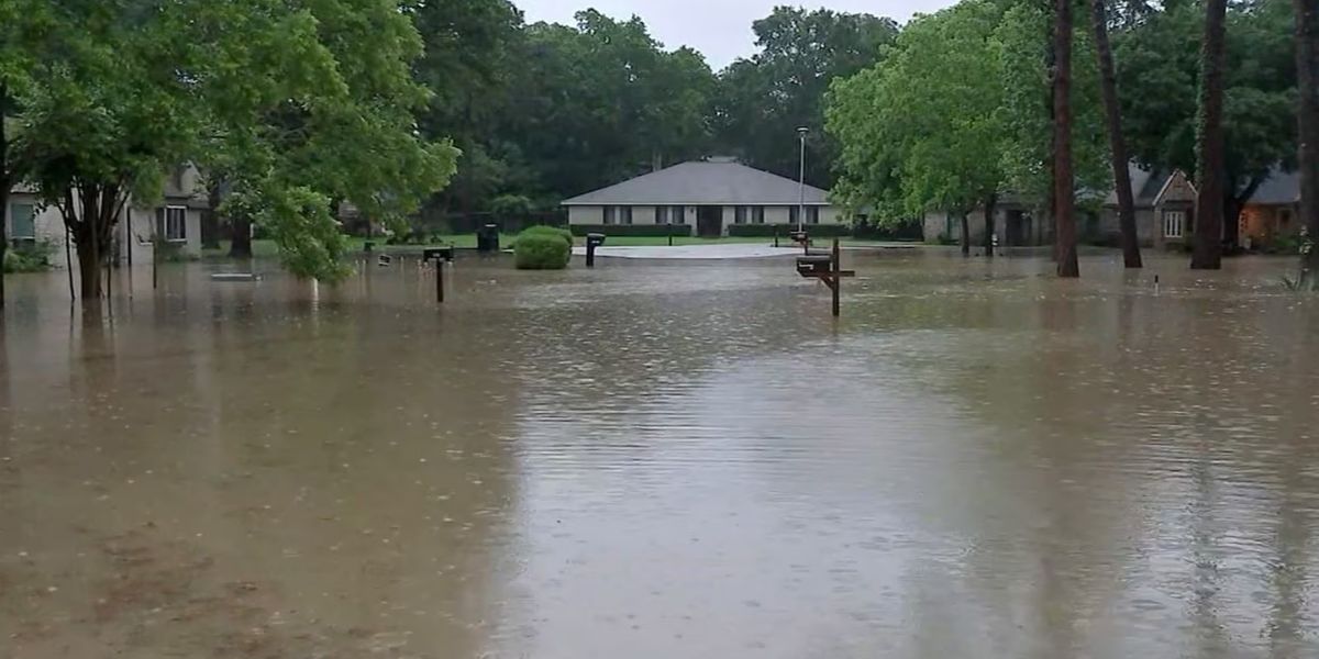
Showers and thunderstorms will move throughout Central Illinois from midmorning to early afternoon. These storms will not be strong, but they may bring significant rains. After 2 p.m., storm coverage will become more patchy before another round of storms forms along the warm front Friday evening. Some of these storms may be powerful, with hail and strong gusts, but widespread severe weather is not forecast. The Storm Prediction Center (SPC) has maintained a Level 1 risk for severe storms, primarily for any intense storms that may form Friday evening. Rainfall estimates through Friday are expected to range from 0.25 to 0.75 inches, with the largest amounts west of the Illinois River.
Saturday
It will feel like summer, with temperatures reaching the upper 70s and lower 80s with dew points in the mid-60s. The warm wet air will provide enough of thunderstorm fuel, but with the front stalled over Iowa, there won’t be enough forcing to stimulate widespread thunderstorm development in Central Illinois, so most regions will remain dry. Some isolated storm development remains probable, particularly around any remaining outflow boundaries from Friday’s storms.
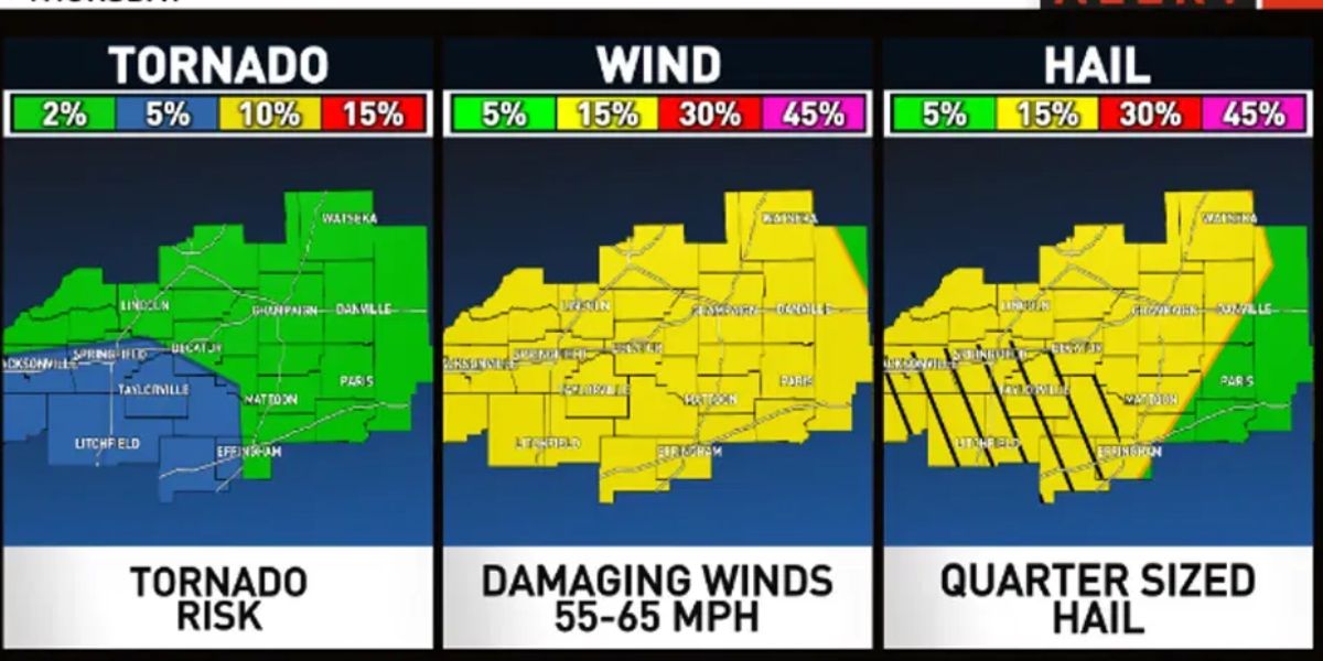
With significant shear and instability, any storms that form will be capable of producing all dangers, including tornadoes, huge hail, damaging winds, and torrential rain. Storms are most likely to develop west of the Illinois River, where SPC has a Level 2 Risk of severe storms. Severe thunderstorms are most likely to develop between 4 p.m. and midnight. Depending on how the storms evolve over Missouri, a couple lines of powerful storms may travel into Central Illinois after midnight. Confidence in the power of these storms remains low.
Sunday
A second storm system will begin to move out of the Central Plains and into the Midwest, bringing another possibility of showers and thunderstorms. Model guidance has been slow with this system, which may keep storms west of the region until late afternoon or early evening. When storms occur, a couple may be intense or severe. The greatest hazard will be damaging winds, but hail and maybe a tornado or two are probable.
SPC has identified numerous places west of I-55 as potentially severe weather on Sunday afternoon and night. The exact timing and location of these storms will be determined by what occurs Saturday night. These storms may bring rainfall ranging from 0.50″ to 2.00″, with potential for higher amounts locally. This should bring rainfall totals to 1-3 inches across much of the region, with locally higher amounts of up to 4 inches likely, primarily west of the Illinois River.