


Oklahoma and Kansas Face Severe Storms: Rare High-risk Warning Issued
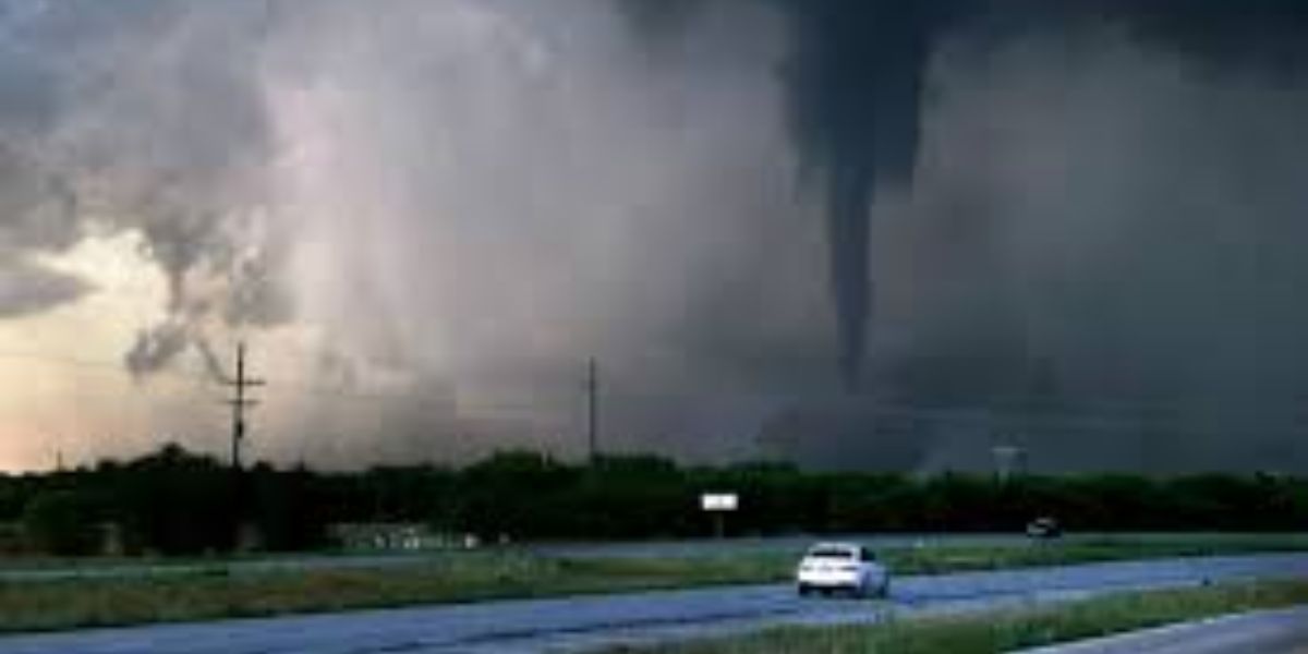
Powerful storms have erupted in the central United States, bringing tornadoes to rural Oklahoma and massive hail to areas of Kansas, with forecasters warning that the dangerous weather might last into the early hours of Tuesday, amid a rare high-risk weather warning for both states.
“You can’t rely on seeing tornadoes before sheltering tonight,” the National Weather Service said Monday.
Gusty winds and heavy rains began Monday afternoon, with tornadoes observed after dark in northern Oklahoma, including one that touched down about 45 minutes north of Tulsa. A storm in the little hamlet of Covington “produced tornadoes off and on for over an hour,” according to the National Weather Service. Wind turbines whirled in the wind and rain all over the area.
In Kansas, several regions were pounded with apple-sized hail measuring 3 inches (7.6 cm) in diameter.
The storms ripped into Oklahoma while places like Sulphur and Holdenville were still rebuilding from a tornado that killed four people and left others without power late last month. Tornadoes wreaked havoc across the Plains and Midwest this spring.
Oklahoma’s State Emergency Operations Center, which organizes storm response from a bunker near the state Capitol, is operational following last weekend’s fatal storms.
On Monday, the Weather Service reported that more than 3.4 million people, 1,614 schools, and 159 hospitals in Oklahoma, southern Kansas, and far northern Texas were under the most severe tornado threat.
Monte Tucker, a farmer and rancher in Sweetwater, western Oklahoma, spent Monday storing some of his tractors and heavy equipment in barns to avoid hail damage. He stated he informed his neighbors that if the weather became dangerous, they might come to his house. “We built a house 10 years ago, and my stubborn wife put her foot down and made sure we built a safe room,” Tucker added. He stated that the entire ground-level room is constructed with reinforced concrete walls.
Bill Bunting, deputy director of the Storm Prediction Center, stated that a high-risk warning from the center is not something that occurs every day or every spring.
“It’s the highest level of threat we can assign,” he said. It was last issued on March 31, 2023, when a huge storm system swept over sections of the South and Midwest, including Arkansas, Illinois, and rural Indiana.
The higher danger is caused by an unusual confluence: Winds gusting up to 75 mph (46 kph) swept through Colorado’s crowded Front Range region, including the Denver metro, on Monday.
According to the National Weather Service’s Denver-area office, the winds are being generated by a low-pressure system north of Colorado, which is also dragging moisture from the Gulf of Mexico, increasing the chance of severe weather on the Plains.
Tornadoes and thunderstorms are unlikely to hit Colorado.
The entire week looks stormy over the United States. The eastern United States and the South are likely to bear the brunt of the terrible weather for the remainder of the week, including Indianapolis, Memphis, Nashville, St. Louis, and Cincinnati, which have populations of more than 21 million. It should become evident over the weekend.
Meanwhile, floodwaters in the Houston region began to recede Monday, following days of torrential rain in southeastern Texas that flooded neighborhoods and required hundreds of high-water rescues.