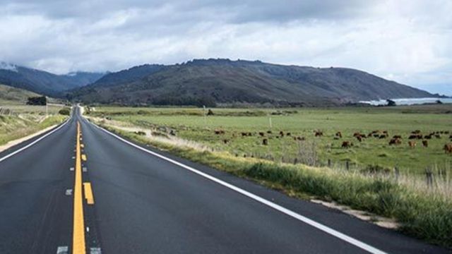
Caltrans reduces the posted speed limit on 44.5 miles of Highway 1 in California
Attention travelers and California coast enthusiasts: The California Department of Transportation (Caltrans) has announced a significant update to the speed limits along key segments of State Route 1, renowned for its breathtaking views along the Big Sur coastline.
Following a meticulous engineering and traffic analysis, Caltrans has identified a 44.5-mile stretch of the highway, all within Monterey County, for speed limit adjustments to enhance road safety for all users.
The revised speed limits encompass three distinct sections of Highway 1. The first adjustment occurs along a 14-mile stretch from the Monterey County line near Ragged Point to just north of the Sand Dollar Beach Picnic Area, where the speed limit will be reduced from 55 to 45 miles per hour.
- Auto Insurance Shopping Rises in Response to Soaring Insurance Rates: Report
- Avoid These 7 Missteps When Refinancing to a Lower Mortgage Rate
- Rising Home Prices Amid Slight Mortgage Rate Dip: Analysis
- Fresno County’s Groundbreaking Initiative: $500 Monthly Payments in New Guaranteed Income Program, Here is Who is Eligible
- Unlocking Financial Freedom: 5 Reasons to Opt for Personal Loans in Credit Card Debt Repayment
The second segment spans 22.5 miles from north of the Sand Dollar Beach Picnic Area to just north of Julia Pfeiffer Burns State Park, with a new speed limit of 50 miles per hour. The final section, an 8-mile span from north of Julia Pfeiffer Burns State Park to just south of Coast Ridge Road, will see a reduction to 40 miles per hour.
These changes are driven by several critical factors identified in the areas in question, including narrower shoulder widths and a high frequency of bicyclists and pedestrians. Caltrans emphasizes that the revised speed limits are a proactive measure aimed at improving the navigability of the roadway, thereby reducing the risk of accidents and enhancing the safety of all who traverse this iconic route.
- Will Everyone Get a $12,000 Stimulus Check in 2024? Find Out Eligibility
- $6400 Stimulus Checks in 2024: What You Need to Know About Eligibility and Payment Dates
- IRS 4th Stimulus Check 2024: Comprehensive Guide to Eligibility and Payment Dates
- 3 Smart Moves to Make Once Your Savings Reach $50,000, Here Are Crucial Actions to Take
- 3 Effective Ways to Pay Off Student Loans on a $50K Salary or Less, Know Here!
Monterey-area California Highway Patrol Captain Ian Troxell echoed the sentiment in a press release, stating, “Slower speeds will afford motorists greater reaction time in navigating the roadway, reducing the likelihood of collisions, and enhancing overall road safety.” He highlighted the importance of adapting to the unique challenges of the corridor’s infrastructure and traffic patterns to ensure the safety of the diverse mix of travelers it attracts.
The decision to adjust speed limits comes in the wake of challenges faced by the Big Sur stretch of Highway 1, including landslides triggered by severe storms in recent winters that isolated communities near the highway.
Moreover, the area has witnessed dramatic incidents, such as a driver who, in February, survived a two-day ordeal after plunging off a cliff along the route near Monastery Beach.
This initiative is part of a broader Caltrans program aimed at evaluating and adjusting speed limits across state highways in District 5, which encompasses the Central Coast.
The implementation of these new speed limits is anticipated to be completed by the end of the month, following the replacement of speed limit signs in the affected areas, ensuring a safer and more enjoyable experience for everyone venturing along the scenic stretch of California’s Highway 1.


